AveniAdventures
  • aveniadventure
  • Blog
  • Contact

Galway Cathedral

5/28/2019

0 Comments

 
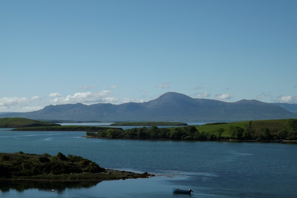
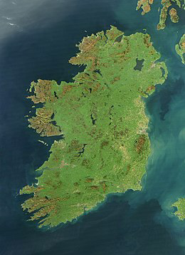
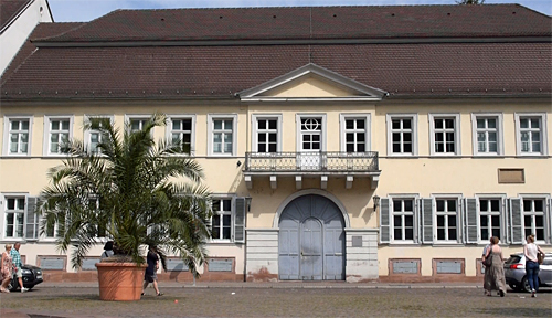
The diocese of Galway was established in 1831, but without a Cathedral. St. Nickolas Parish church functioned as a “temporary” Cathedral (or pro-Cathedral) until 1965, when the present structure was completed (even though it was made to look much older). The Cathedral is located in the part of Galway City known as “Nuns Island” because the island was given over to the “Poor Clare’s” (Oder of Nuns) in 1649. Previously, this site on the West Bank of the Corrib River (near the Salmon Weir Bridge) was home to the old Galway jail. In 1941, the County Council handed over the jail property for the purpose of a new Cathedral. The jail was demolished in 1949 and two years later the foundation stone for the new Cathedral was laid.
When construction was completed, the Cathedral was officially opened (on August 15,1965), led by the Archbishop of Boston, Richard Cardinal Cushing, who was serving as the Papal Legate ( personal representative of the Pope). Documentation indicates that Cardinal Cushing had given $200,000 towards the Cathedral building fund on behalf of the Irish-American community in-and-around Boston (we wonder if the Boston community knew of this and agreed with the money being given. Hmmm?).
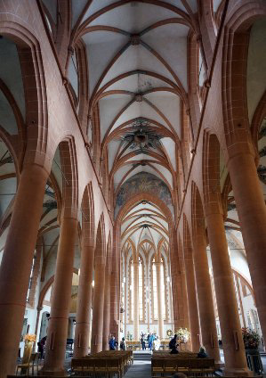
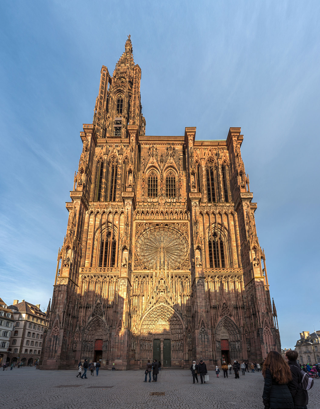
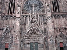
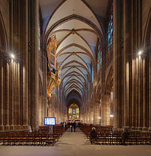
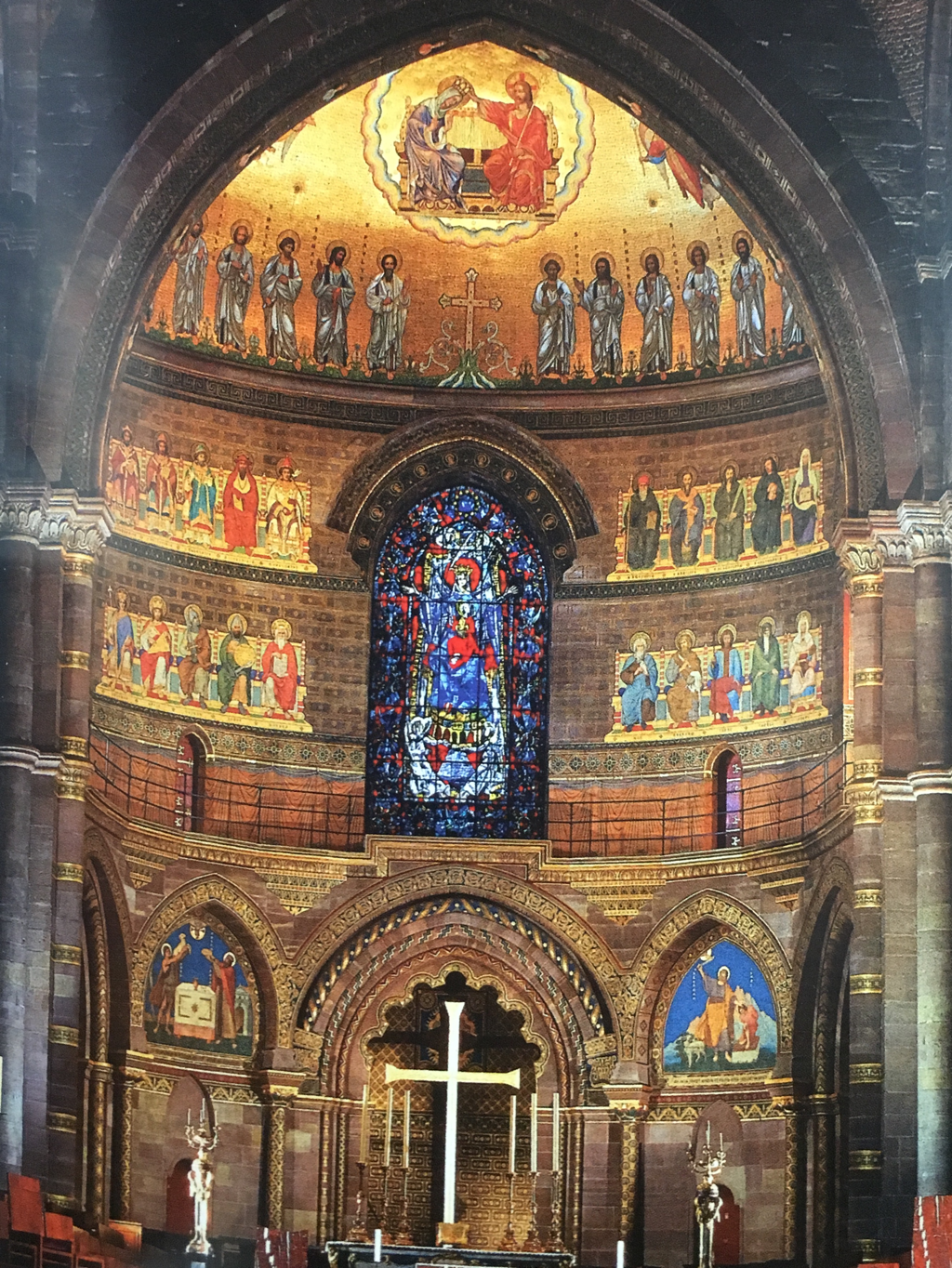
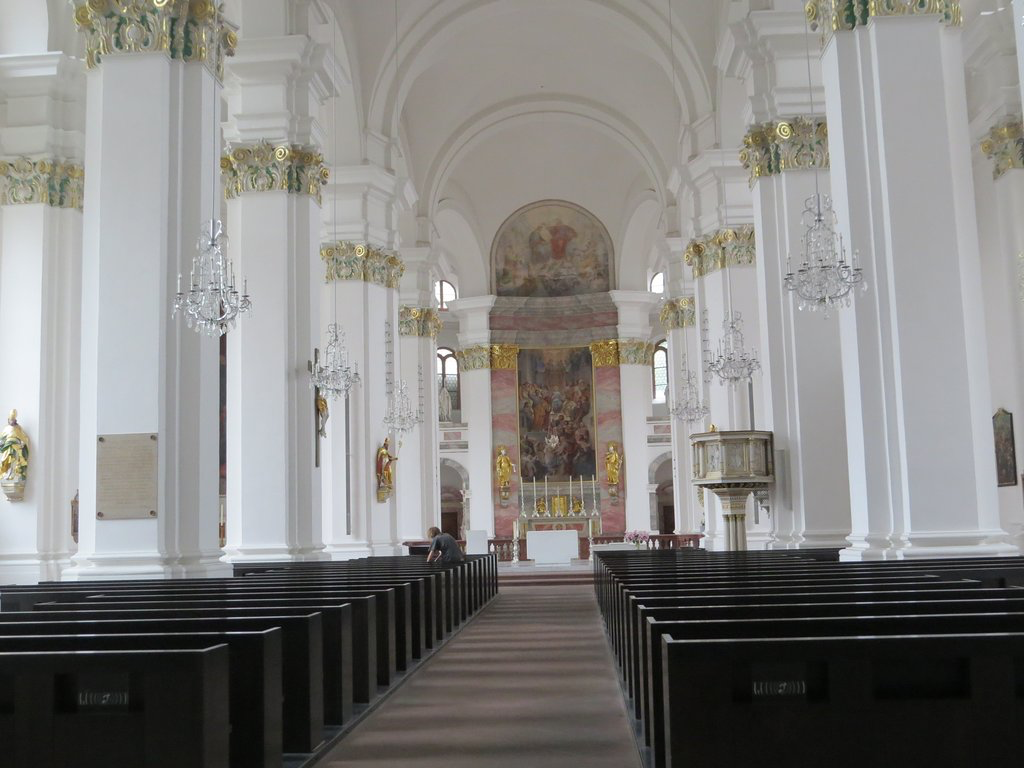
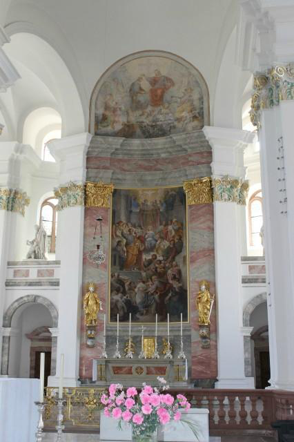
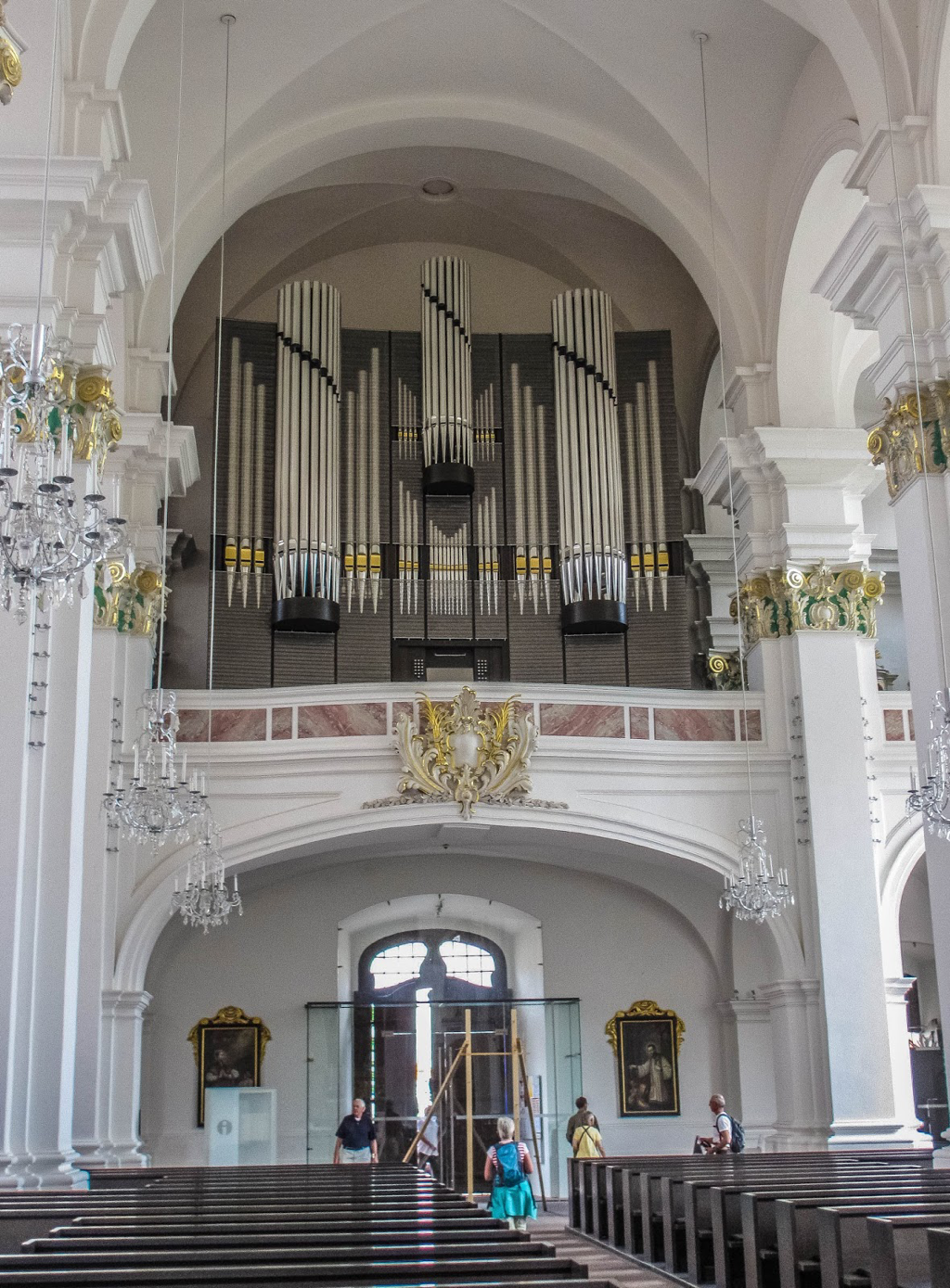
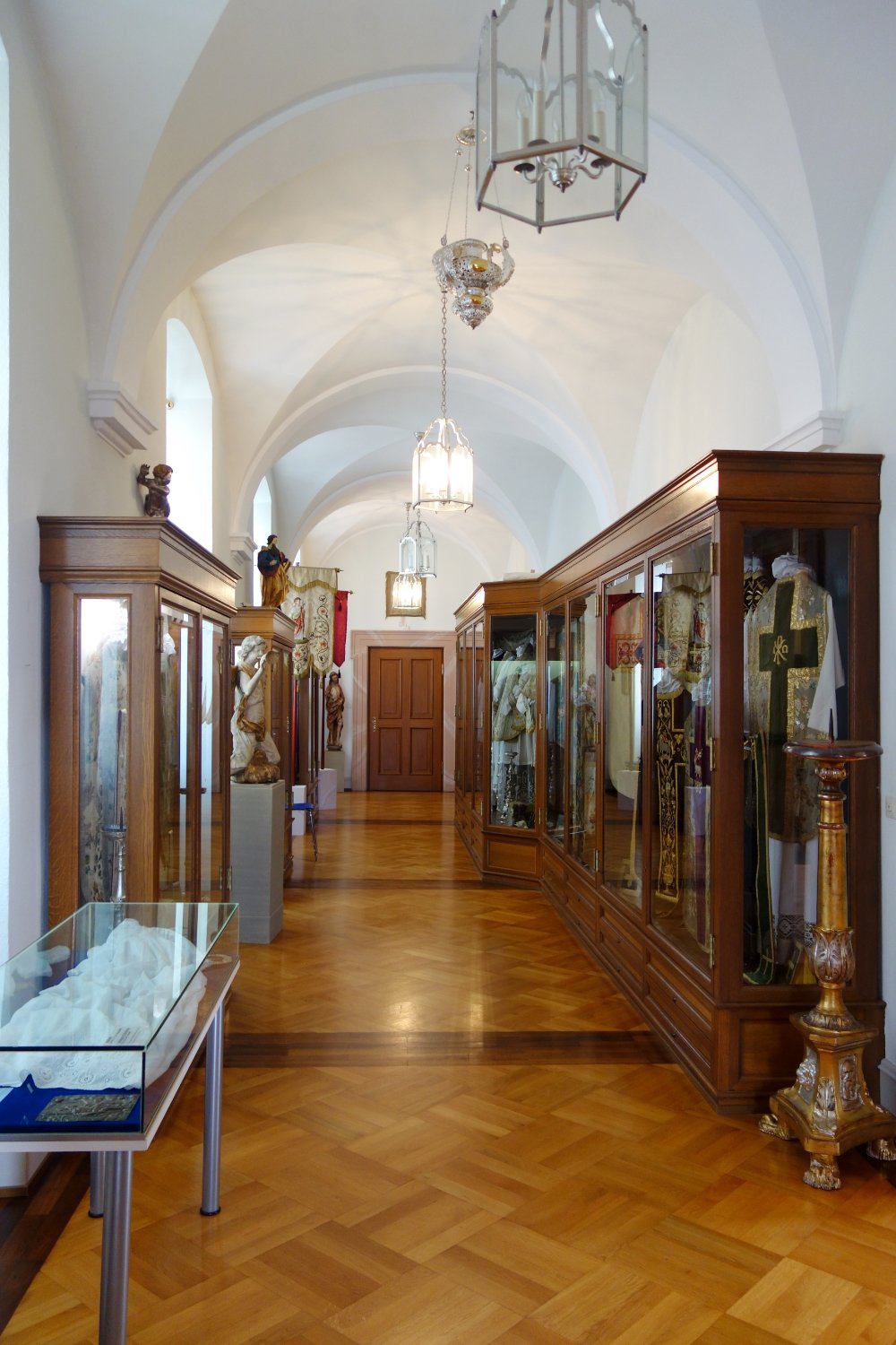
According to reviews, the structure is a mix of architectural styles; Renaissance on the exterior facade; Gothic arches in the Nave; with a Spanish feel to the side aisles; and a Romanesque tower. The interior is a repository of religious art covering the last 50 years or so. Behind the altar is a huge Crucifixion mosaic that has been described as being made of “...impossibly tiny colored tiles.”
While the Poor Clare Nuns no longer own the property, they do still maintain a convent nearby.
We have enjoyed visiting various religious buildings of differing denominations as we traveled the world, including the Galway Cathedral.. However, we never-the-less were surprised at how relatively young this building was.
Picture
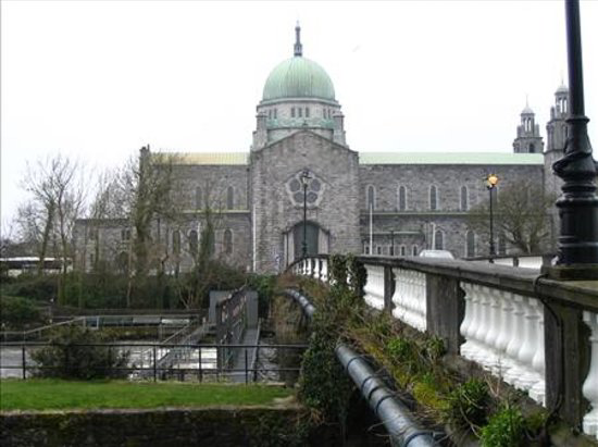
Nuns Island (looking across the Salmon Wier Bridge over the Corrib River) is home to the Galway Cathedral.
Picture
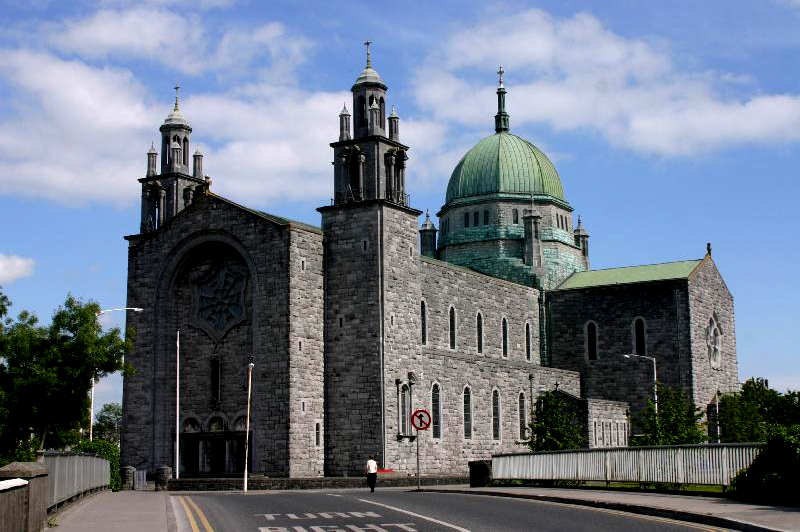
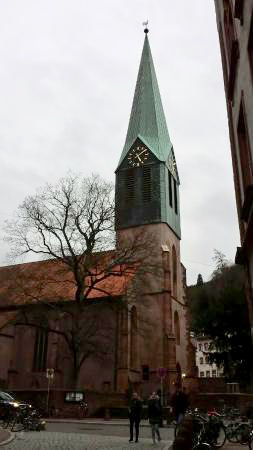
While construction was completed in 1965, the Cathedral does have the look of having come out of the Middle Ages.
Picture
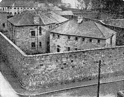
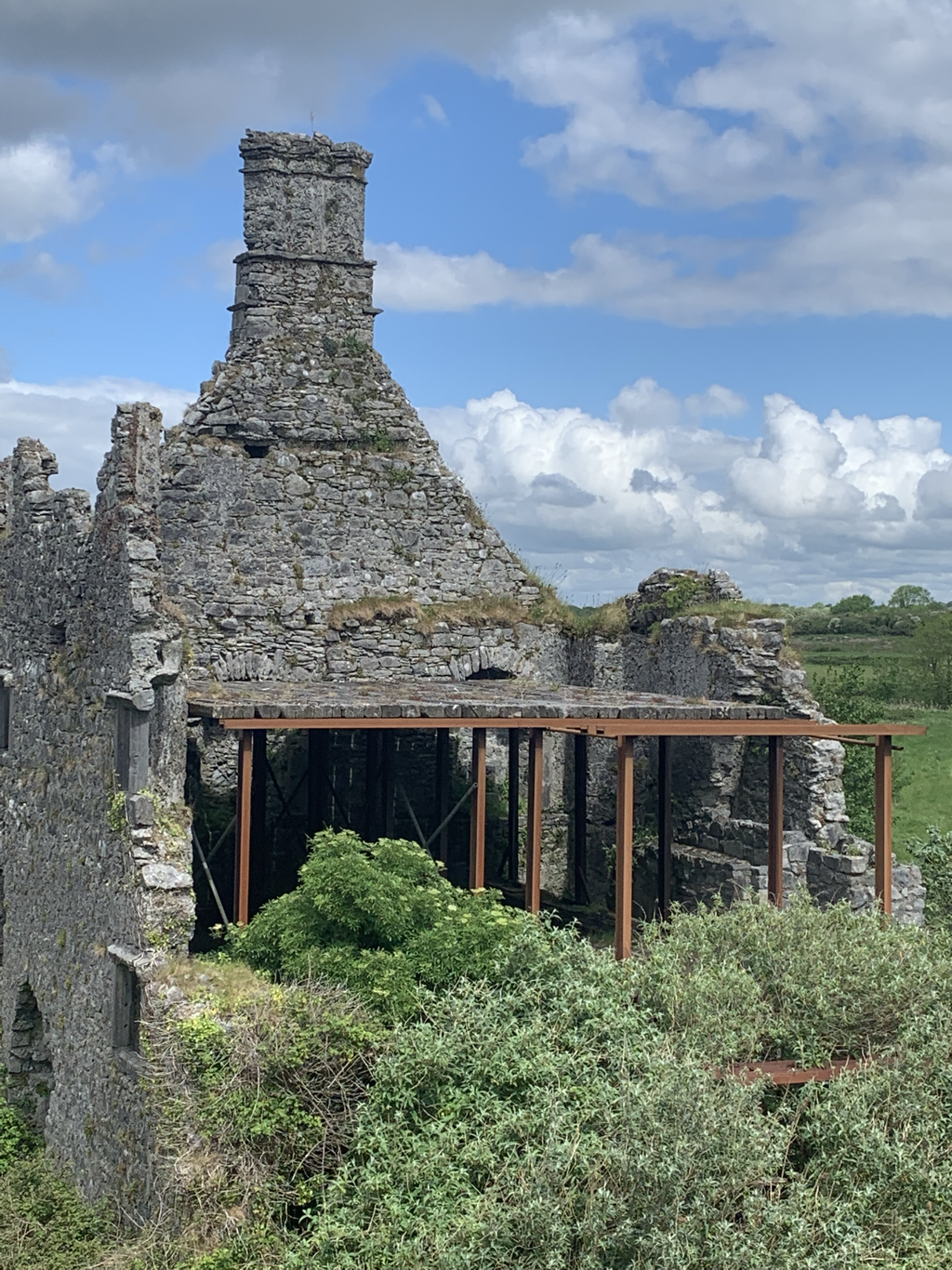
Prior to the construction of the Cathedral, this property was the site of the Galway Jail. It was demolished in 1949 to make way for the Cathedral.
Picture
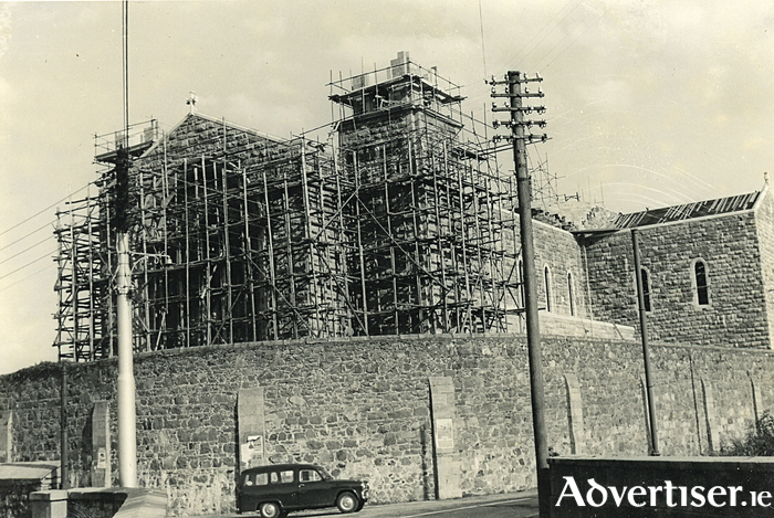
Formal construction began in 1951, reaching completion in 1965.
Picture
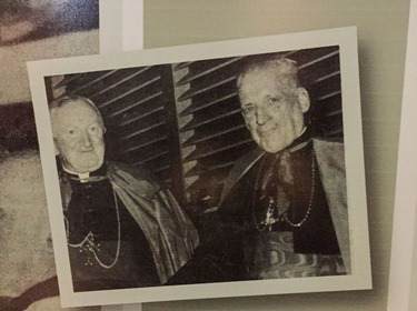
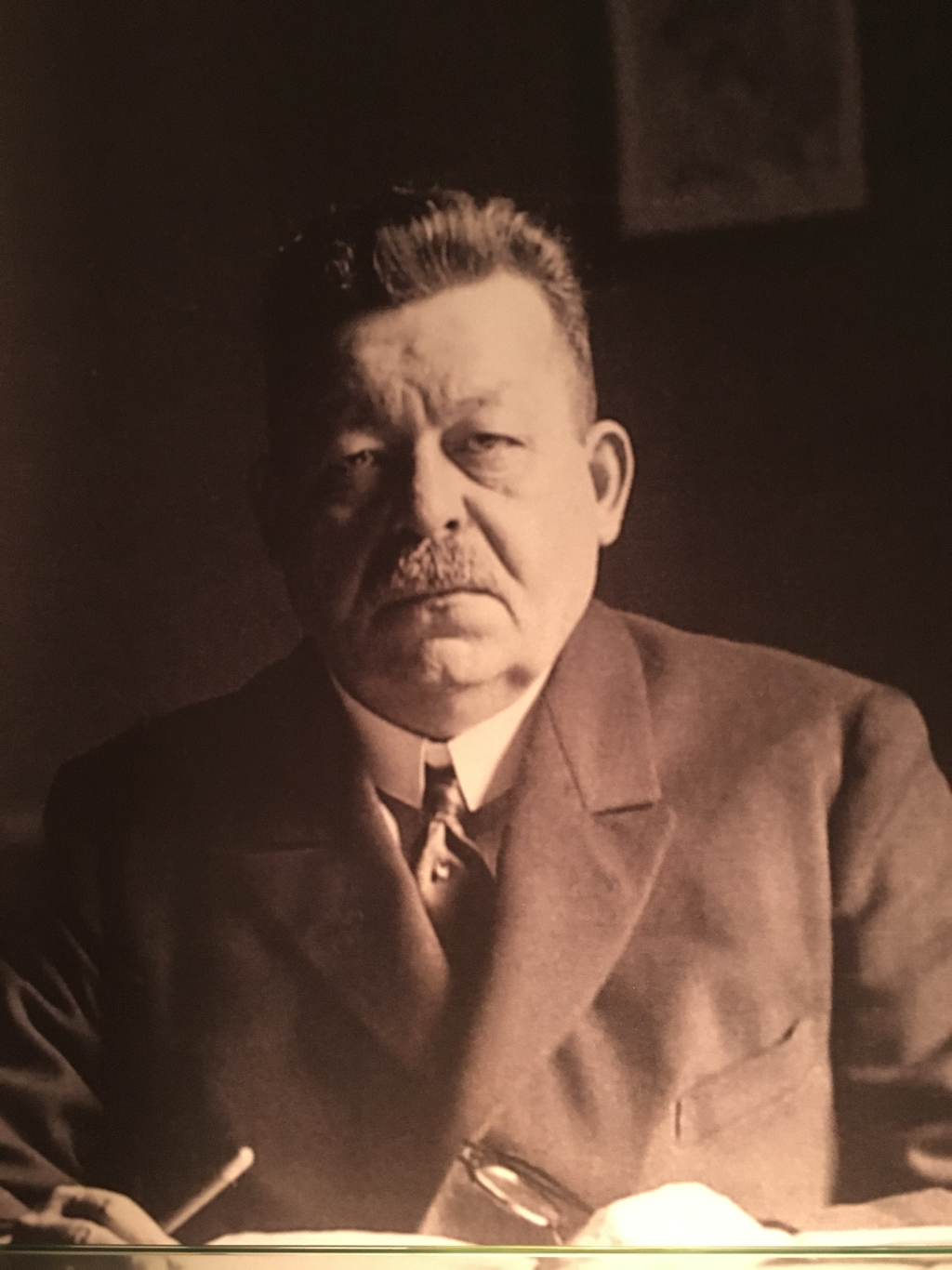
Bishop Michael Browne (of Galway) on the left, with Richard Cardinal Cushing (Archbishop of Boston and Papal Legate to the Cathedral’s dedication) on the right.
Picture
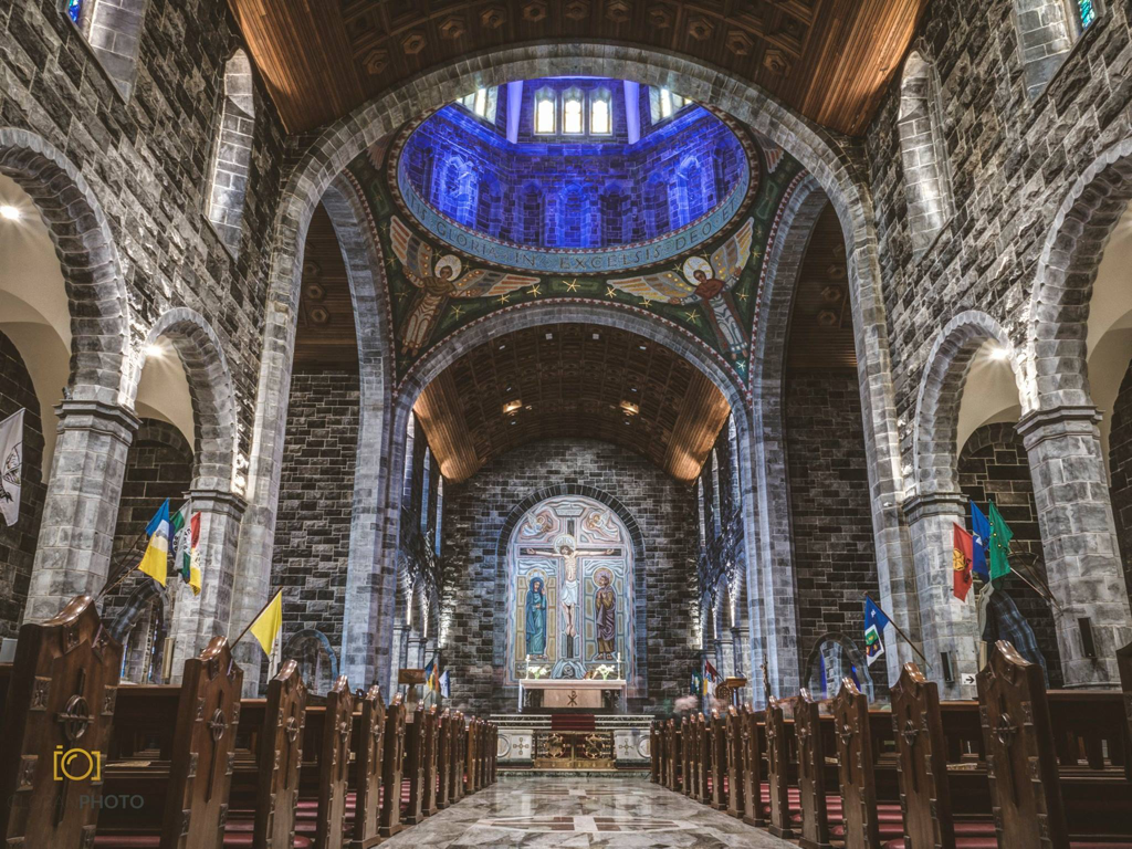
While not quite as grand as other cathedrals we’ve visited, they did try to make it attractive.
Picture
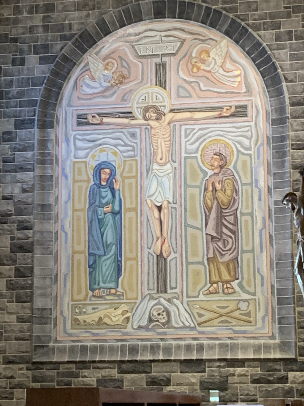
Created with the use of “very tiny” colored tiles, this Crucifixion mosaic dominates the wall behind the main altar.
Picture
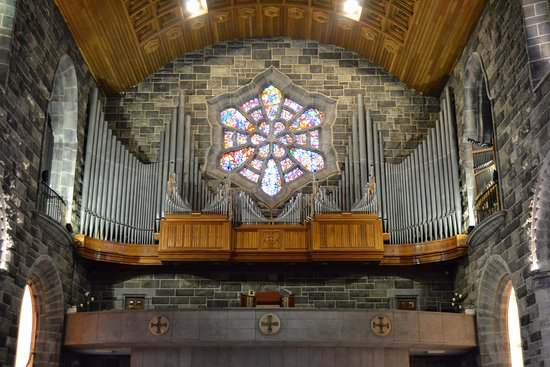
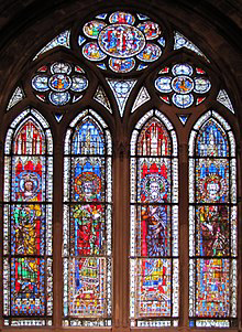
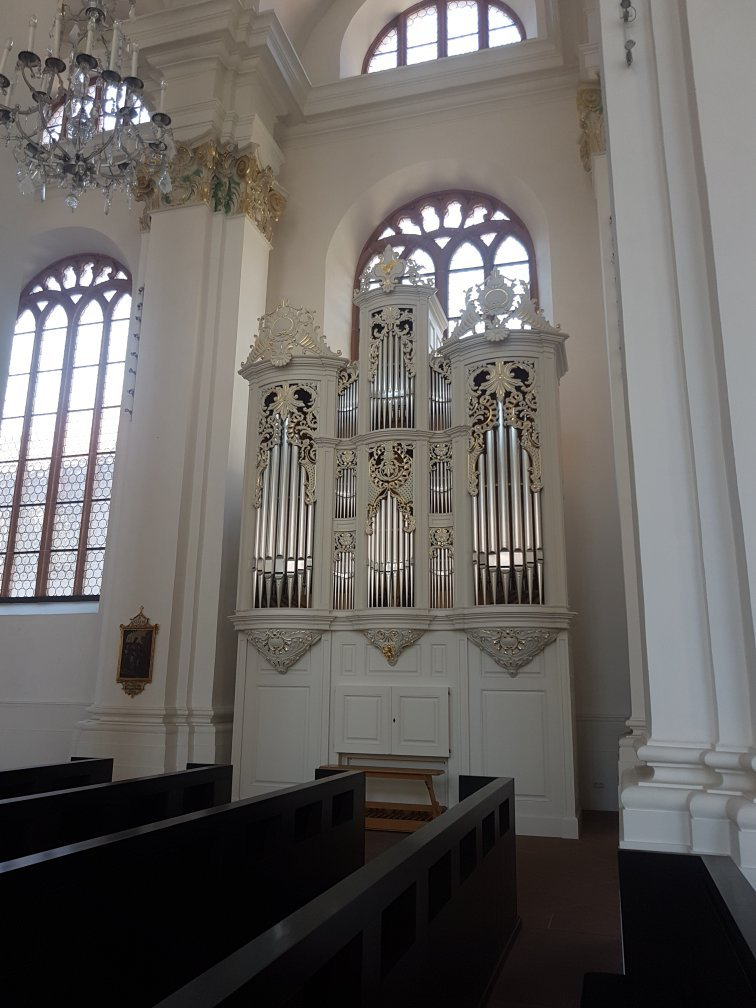
One of the other top features of the interior is this attractive stained glass window above the organ.
0 Comments

Corrib River

5/24/2019

1 Comment

 
Every major city that we’ve visited in Europe during our travels has been founded along a river, because of its access to food resources. Galway City is no exception to that concept. Its main river is the Corrib which was originally named the Galway River. According to local legend, the river derived its original name from Gallimh Inion Breasail, a daughter of a local chieftain, who drowned in the river. The earliest settlement at the mouth of the river was called “Dun Bhun na Gallimhe” (“The fort at the end of the Galway River”). The river flows from “Lough Corrib” (Lake Corrib) through Galway and into Galway Bay. It is one of the shortest rivers in Europe (only 3.7 miles), but is the second fastest (after the Shannon River) on the continent. Lake Corrib is the Anglicanised form of the name for the Irish god of the sea. The very first canal in Ireland was constructed during the 12th century. Known as “Friar’s Cut,” it allowed boats to pass from Lake Corrib to the sea at Galway.
​ As it travels from Lake Corrib towards the sea, it passes the ruins of Menlo Castle (built in the 16th century), the Martin Tea House Folly ( an early 19th century oratory, or stone church), and Terryland Castle (constructed during the 17th century). We will visit each of these sites in later postings.
As the river passes through Galway City - between the neighborhood of Claddagh and Galway’s Latin Quarter - a “Watch Tower” stands as a sentinel over it. At one time, the River was privately owned and locals had to purchase permits in order to fish its waters. It was constructed to keep track of these activities. Today, the Watch Tower serves as the river’s museum. A walking tour from the Watch Tower up to Lake Corrib ( or vice versa) makes an enjoyable day trip (although a bit long because of the winding trail that sometimes meanders away from the river).
Picture
Three point seven miles from the sea, Lake Corrib serves as the source for the Corrib River.
Picture
Along the banks of the lake is the 13th century Ashford Castle, which has been transformed into a five star luxury hotel.
Picture
As you exit the lake and start traveling down the river, you pass the ruins of this 16th century Menlo Castle. It was destroyed by fire in 1910. We took this photo from a delightful walking trail on the opposite side of the river.
Picture
Diagonally opposite Menlo Castle is the Martin Tea House Folly, a 19th century oratory, or early stone church.
Picture
This part of the river is used by rowing clubs from the nearby National University of Ireland, Galway as well as from local high schools.
Picture
As we traveled along the river, and just before getting into Galway City proper, we came across the ruins of the 17th century Terryland Castle.
Picture
Situated between Galway’s Latin Quarter and the neighborhood of Claddagh, this Watch Tower stands guard over the Corrib River as it enters Galway Bay.
Picture
Swans enjoy the relative calmness of the Corrib as it enters Galway Bay.
Picture
These colorful houses along the mouth of the Corrib River are reminiscent of the Rainbow Houses in Charleston, South Carolina.
1 Comment

Ireland

5/21/2019

0 Comments

 
According to our DNA analysis, Lori’s ancestry rates at being 99.7% Irish (of course, she always knew that). For that reason, we wanted to visit those parts of the Emerald Isle from which her relatives emigrated.
Picture
Ireland is situated in the North Atlantic and is separated from Great Britain by the North Channel, the Irish Sea, and St. George’s Channel. Politically, it is divided into the Republic of Ireland (which makes up 5/6 of the landmass) and Northern Ireland (which remained part of the United Kingdom). The earliest evidence of human habitation here dates back to 10,500 B.C. However, it was not until circa 8000 B.C. that any substantial occupation was demonstrated. Most of these “permanent” settlements were established by hunter/gatherers close to the sea (or inland waterways) because of good food resources.
Picture
Gallarus Oratory - one of the earliest stone churches in Ireland.

​GALWAY CITY - One branch of Lori’s ancestors were centered in and around County Galway; so we headed there first. Galway City is a harbor town on the west coast of Ireland (where the river Corrib meets the sea). Its name derives from the Irish “Gallimh” meaning “Stoney River.” It is also known as the “City of Tribes” as 14 merchant families, or tribes, formed the settlement. In 1124, the King of Connacht had Fort Gallimh constructed. During the Norman invasion of the 1230’s, the fort was captured by Richard Mor de Burgh, who was then granted mayoral status by the English monarchy. At that period of time, the Normans had unrestricted access to the city, while the native Irish had to be outside the gates by sundown. While on a voyage to Iceland and the Faroe Islands In 1477, Christopher Columbus stopped in Galway.
Throughout the Middle Ages, Galway was ruled by an oligarchy of 14 merchant families, known as the “Tribes of Galway”. The city was thriving on international trade, mostly with Spain and France.
Picture
For most of the 16th and part of the 17th centuries, Galway remained loyal to the English Crown. However, by 1642, it had allied itself with the Catholic Confederation of Kilkenny, which did not please the English monarchy at all. Oliver Cromwell was sent to bring them back in line. Between 1649 and 1652, Cromwell set out to capture the city, laying seige to it for nine months, until it surrendered. His troops were brutal towards the Irish, showing them no mercy. To this day, most Irish hate Cromwell’s name.
The potato famines of 1845 until 1852 devastated the city and the whole Island. Full recovery from this disaster did not occur until the 20th century.
Today, Galway is a thriving city with tourism being one of its main industries. We look forward to our stay here.
Picture
0 Comments

Heidelberg Wrap-up

5/14/2019

0 Comments

 
There are so many wonderful places to explore in Heidelberg, that we could not really do justice by attempting full postings on all that we visited (we would be creating columns of material). Instead, we will present a brief synopsis of some of those remaining sites, not yet written about and that stood out in our minds as memorable;
ST.PETER’s CHURCH - This is the oldest preserved church within Old Town (located opposite the University of Heidelberg Library). While there is no evidence to prove it, oral tradition states it may have dated back to the 12th century. We do know that there were Christian ties to the University back to the 14th century. It’s unigue character of orange walls and a red roof indicate that it was an example of early Baroque architecture with Romanesque influences. Outside, the old cemetery has graves that cover five centuries and an elegant oak tree that was planted in 1883 on the 400th anniversary of Martin Luther’s birth.
Picture
The oldest church in Heidelberg, St. Peter’s, (which most likely dates back to the 12th century), is on a back street of Old Town, opposite the Library of the University of Heidelberg.
Picture
The interior is just as impressive as the exterior.
Picture
Over five centuries are represented in the church’s cemetery.

WITCH TOWER - Also known as the “Thief’s Tower,” this was once part of the western city fortifications until 1392. Later on, it functioned as a jail for both male and female robbers and thieves. The tower did not get its name as the “Witch Tower” until 1684 (the witch hunts having taken place much earlier, between 1450 and 1500), to emphasize the brutality of the jail. It was partially destroyed during the War of Palatinate Succession (1688 - 1697). When it was rebuilt, the tower no longer had a peaked roof, as hip roofs were then in fashion. Today, the tower is located in the yard of the New University.
Picture
Seemingly out of place on the New University campus, the Witch Tower (or Thief’s Tower) harkens back to medieval times when punishment was brutal.
Picture
Curious as to why the archways are so open, and where would the cells have been? Unfortunately, no written documentation was available to us to explain this.
Picture
Circa 1900 photo of the tower.

KARLSPLATZ (KARL’S SQUARE) - Named after Grand Duke Karl Friedrich of Baden, it occupies an area that once held a Franciscan monastery (until 1803). It offers an unhindered view of Heidelberg’s Castle. Created in 1805, it is the home to the Sebastian-Munster fountain (1978) which honors the German humorist of the same name. He worked for many years, during the 16th century, in the monastery, on its grounds. It also hosts the Palau’s Boisseree and Rosshiry Residence building.
Picture
Karlsplatz (Karl’s Square), which sits on the former site of a Franciscan Monastery, offers an unobstructed view of Heidelberg’s Castle.
Picture
The central feature of the square is the fountain dedicated to the 16th century German humorist, Sebastian Munster, who had worked on the grounds of the Franciscan monastery that had once occupied this site.
Picture
Another feature of the square is the Palais Boisseree. Built between 1703 and 1705, it was made famous by the brothers Sulpiz and Melchoir Bousseree who exhibited their collection of Old German paintings here.

FRIEDRICH EBERT HOUSE MUSEUM - Ebert was the first democratically elected president (during the Weimar Republic) in German history. He was born in this small three room apartment in February of 1871 to a master tailor ( who also ran his shop out of the apartment) and his wife. Friedrich was the seventh of nine children. The museum retraces the steps that Ebert took in order to become leader of Germany.
Picture
Stairs on the opposite side of this courtyard lead to Friedrich Ebert’s house.
Picture
This was not a very large apartment...
Picture
... considering that there were two adults and nine children living here.
Picture
And,yet, the elder Ebert was able to allocate enough space for his tailor shop.
Picture
From those humble beginnings, Ebert rose to become the first elected president of the Weimar Republic.
JEWISH SYNAGOGUE REMAINS - There has been a Jewish presence in Heidelberg, dating back to the 13th century, in a community building that had been converted into a synagogue. During the Nazi’s “Krystallnacht” (“Night of Broken Glass”) - November 9, 1939 - the synagogue was burned to the ground. The “Old Synagogue Square” ( a short distance from the edge of Marketplatz) is all that remains, with the outline of the walls marked by white marble, and 12 sandstone cubes representing its pews, as well as the 12 tribes of Israel.
​
Picture
The white marble outline indicates the exterior walls of the Jewish Synagogue of Heidelberg, which was burned down during “Krystallnacht.”
Picture
To commemorate our visit to this site, Lori places a white stone on the former synagogue’s altar.

Our three months in Germany are finished and what a wonderful time we had. There are just so many places to explore in any of the countries we’ve visited, Germany included, that being restricted to just ninty days within the Shengen (the treaty that covers 30 countries of the European Union) creates a problem for our travels. We now have to leave for three months before we can return to the EU. Finding non-Shengen countries does present some challenges. So our next journey will take us to Ireland. While a member of the European Union, Ireland is not part of the Shengen treaty. Oh well, ever onward.
0 Comments

Strasbourg

5/7/2019

1 Comment

 
Time for another day trip! Eighty-two miles south of Heidelberg is the French-German border town of “Strasbourg” ( meaning “Town at the crossing of roads”). It’s fertile plains, between the Ill and Rhine rivers, have been inhabited since the middle-Paleolithic period (known as the “Old Stone Age”) - approximately 300,000 to 30,000 years ago. During the Time of the Romans, they had a settlement here (known as “Argentoratum”) that was first mentioned in 12 B.C. For 900 years (362 to 1262), the area was governed by the Bishops of Strasbourg. In the end (i.e. 1262) the locals violently rebelled against the Bishops’ rule and created a “free imperial city” (self-rule)
In the mid-1400’s, Strasbourg became one of the first centers in Europe to utilize Gutenberg’s revolutionary printing press. When Louis XIV conquered the Alsace region, it became a French city. Following the Franco-Prussian war (1870), Strasbourg became part of Germany. However, after the end of World War I, it reverted back to French ownership.
Today, Strasbourg is the capital city of the Grand EST region of France (formerly Alsace) and is one of three main capitals of the European Union (along with Brussels and Luxembourg ). It’s chief tourist attraction is the sandstone Gothic Notre Dame cathedral, with its famous astrological clock. The current clock is actually the third one in the church; the first clock, known as the “King’s Clock,” was built between 1352 and 1354. When it stopped working in the mid-1500’s, a second clock was constructed to replace it. This one lasted until 1788, when it also stopped working. Because of funding and political issues at the time, construction of the third (and current) clock was not completed until 1843. It’s main automaton features are 18” figures of Christ and His apostles in procession each day at solar noon, while the clock “crows” three times ( a throw back to the second clock which had an automaton rooster that would flap its wings and crow).
What a wonderful time we had visiting this quaint, old medieval looking village, thanks to our son, David’s, suggestion.
Picture
Strasbourg, on the French-German border, is one of the most beautiful old cities we’ve visited.
Picture
Except for the existence of a passing tourist boat, we felt we were back in the Middle Ages.
Picture
This circa 1900 photo of the Maison Kammerzell (built in 1427) depicts how “the other half” lived. Oh, what a life!
Picture
A statue depicting Johannes Gutenberg (next to an old style carousel) sits in the middle of one of the town squares.
Picture
Hmmm, should we go for a ride..or continue sightseeing?
Picture
Not everything is old here; the Museum of Decorative Arts is quite modern.
Picture
By far, THE number one attraction in Strasbourg is the Gothic Notre Dame Cathedral.While construction began in 1015, the structure was not completed until 1439.
Picture
The intricate exterior stonework is unbelievable! No wonder it took over 400 years to complete construction.
Picture
Of course, the interior workmanship is another level of amazement!
Picture
We’ve visited a number of cathedrals around the world that are called “Notre Dame” (e.g. Paris, Montreal, etc.). This one easily ranks near the top as the most beautiful.
Picture
For us, one of the telling indicators of how beautiful we feel a Cathedral is comes from the colors of its stained glass windows. Since reds and blues are the most expensive, the more of these in the windows shows how important a message the creators are trying to impart.
Picture
What makes Strasbourg’s Notre Dame Cathedral stand out as being unique is its famous Astrological clock. The original clock (the current one being the third) was built in 1352. Figures of Christ and the Apostles parade across the clock each day at solar noon.
1 Comment

Jesuit Church

5/2/2019

0 Comments

 
Tucked away in an alley, a short distance from the University of Heidelberg, is the beautifully Baroque Jesuit Church. Modeled after the Jesuit Church in Rome, Heidelberg’s Jesuit Church’s foundation was first laid in 1711, but construction was not completed until 1759 (its tower was added later, between 1866 and 1872). The Jesuits, who ran the Jesuit College next door, owned the church until its order was abolished in 1773. For a brief period afterwards, the building became the property of the Catholic organization known as the “Lazarists” (founded by St. Vincent de Paul at the priory of Lazare in Paris). Later, the church was used for a number of secular purposes, including as a military hospital. By 1809, the building once again came under the control of the Catholic community, as a parish church.
Unfortunately, most of the Baroque interior was not preserved. Only the central altar painting was saved. The tomb of Prince Elector Friedrich the Victorious (1425-1476) is located in the north-east corner of the church. Near the easterly doors is the entrance to the former Jesuit College, now used by the University of Heidelberg for its philosophical seminary and by the office of administration. The church is also home to a Museum of Ecclesiastical artifacts from the 17th to the 19th centuries.
While the Jesuit church of Heidelberg is at the end of an alley off of Old Town’s main thoroughfare (the Haupstrasse), it is easy to find and well worth a visit.
Picture
Situated at the end of an ally between Marketplatz and the University of Heidelberg, the Jesuit Church, with its distinctive pink coloring, is quite visible. The former Jesuit College is next door.
Picture
What a gorgeous building! We were totally amazed!
Picture
At one time, the interior was decorated with Baroque artwork. Unfortunately, most of it was not preserved.
Picture
The only piece saved was the painting behind the central altar.
Picture
Another feature of the interior is this elaborate and quite ornate pulpit.
Picture
The main pipe organ is very elegant looking...
Picture
...as is its Little Sister on the ground floor.
Picture
Friedrich The Victorious, of the house of Wittlsbach, ruled from 1425 until 1476. His tomb is located within the church.
Picture
Also located within this structure is the Museum of Ecclesiastical artifacts dating from the 17th to the 19th centuries.
0 Comments
    Carl and Lorraine  Aveni are two retirees planning on traveling through Europe for at least one year.

    Archives

    September 2020
    August 2020
    July 2020
    June 2020
    May 2020
    April 2020
    March 2020
    February 2020
    January 2020
    December 2019
    November 2019
    October 2019
    September 2019
    August 2019
    July 2019
    June 2019
    May 2019
    April 2019
    March 2019
    February 2019
    January 2019
    December 2018
    November 2018
    October 2018
    September 2018
    August 2018
    July 2018
    June 2018
    May 2018
    April 2018
    March 2018
    February 2018
    January 2018
    December 2017
    November 2017
    October 2017
    September 2017
    August 2017
    July 2017
    June 2017
    May 2017
    April 2017
    March 2017
    February 2017
    January 2017
    December 2016
    November 2016
    October 2016
    September 2016
    August 2016
    July 2016
    June 2016
    May 2016
    April 2016
    March 2016
    February 2016
    January 2016
    December 2015
    November 2015
    October 2015
    September 2015
    August 2015
    July 2015
    June 2015
    May 2015
    April 2015
    March 2015
    February 2015
    January 2015
    December 2014
    November 2014
    October 2014
    September 2014

    Categories

    All

    RSS Feed

Powered by Create your own unique website with customizable templates.